When fire tore through Notre-Dame de Paris in April 2019, it highlighted a simple truth: without precise, up-to-date records, restoring complex historic buildings is slower, riskier and more expensive. In the aftermath, France’s cultural bodies and tech partners expanded laser scanning and digital twin initiatives across priority cathedrals and monuments—so if disaster strikes again, teams can rebuild with certainty. This isn’t a literal scan of every protected building, but a coordinated, nationwide push focused on high-priority assets using scan-to-BIM and advanced photogrammetry. CNRS News
What changed after the Notre-Dame fire?
Notre-Dame had an unusual head start: detailed pre-fire laser scans captured by the late art historian Andrew Tallon, complemented by further surveys and BIM support that combined pre- and post-fire reality capture into a working model for the restoration authority. See coverage by Wired
French research bodies most notably CNRS launched a broad scientific programme to build a digital twin of the cathedral that centralises survey data and diagnostics, enabling cross-disciplinary conservation. Sorbonne University’s teams have also been digitising décor via the PLEMO 3D platform, using lasergrammetry and photogrammetry to create shareable, research-grade records. CNRS News+1

Is France scanning all heritage buildings now?
Not literally, but multiple national and regional programmes prioritise cathedrals and major monuments, and the ecosystem keeps growing. Recent reports describe public-private collaborations to produce highly detailed digital replicas for preservation and public access, building on extensive survey and modelling already completed for Notre-Dame. Reuters
Why laser scanning?
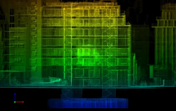
- Survey-grade accuracy for reconstruction – Dense point clouds capture complex geometry—vaults, ribs, tracery—at millimetre-level precision, enabling faithful re-creation after loss. (Background on Tallon’s scans via National Geographic.) National Geographic
- A shared BIM environment – Laser scans feed Revit/IFC models so architects, engineers and craftspeople can coordinate, find clashes early and reduce rework. (Autodesk restoration brief.)
- Conservation insight – Digital twins support scientific diagnostics (deformation, stone decay, ironwork studies) and inform repair strategies. (CNRS articles and peer-reviewed work.) CNRS News+1
- Public access and education – Universities and partners use the datasets for exhibitions, VR and online collections, widening engagement with heritage. (Sorbonne exhibitions.) Sorbonne Université

Common myths (and what’s actually true)
Myth: A video game provided the key 3D data for restoration.
Reality: Game models are artistic recreations. The restoration relies on expert laser scans and scientific digitisation campaigns, combined into a robust BIM/digital-twin workflow. (See Wired/NatGeo and Autodesk.) WIRED+1
Myth: France scanned every historic building after 2019.
Reality: France prioritised major monuments and cathedrals through national and regional efforts; coverage continues to expand with new collaborations and public-facing replicas. Reuters
What this means for UK projects
France’s experience shows that high-fidelity as-built documentation is the best insurance policy for irreplaceable buildings. For listed assets and complex refurbishments in the UK, the same approach, 3D laser scanning → point cloud → Revit (scan-to-BIM) reduces risk, accelerates approvals and preserves knowledge for the long term.
If you’re planning heritage or refurbishment work, we can help with:
- Laser Scanning – site capture and point clouds.
- Scan to BIM – Revit/IFC models from scans.
- Measured Building Surveys – 2D plans, sections, elevations.
- Topographical Surveys – site levels and features.
- Rights to Light Survey – accurate geometry to support assessments.
Call to action: Planning a heritage project or resilience strategy? Talk to Modelling Architecture about laser scanning and scan-to-BIM deliverables for conservation-grade accuracy.